Brunswick is a gold exploration project in the Timmins area of Ontario.
Project overview
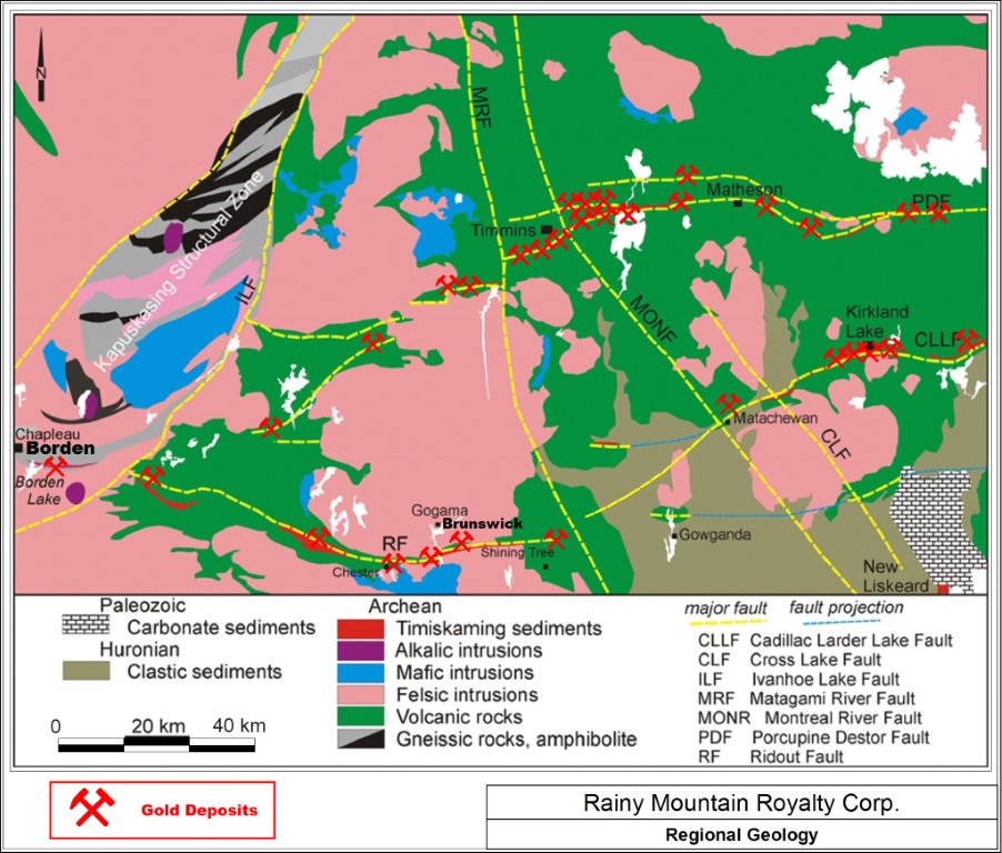
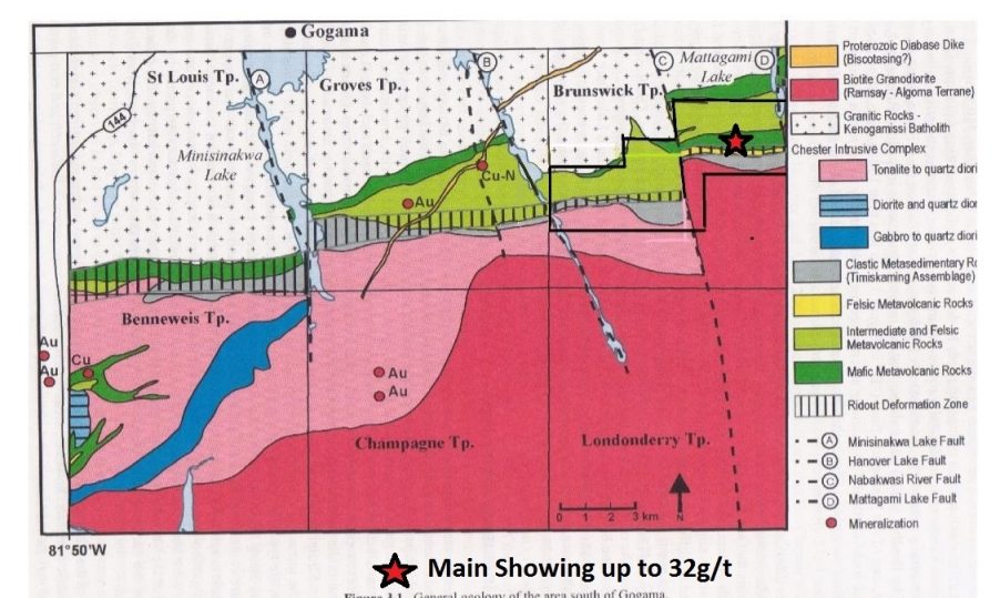
The Brunswick Property covers a six mile long section of the Ridout Fault Shear Zone, which is an extension of the Larder Lake Break (fault zone), as associated with the Kirkland Lake and Larder Lake Gold Camps (the Kirkland Lake Gold Camp is 125 km northeast of the Property and the Larder Lake Gold Camp is 167 km northeast of the Property).
Exploration history
Trenching and geophysical work in 2017 defined targets on the East Grid. A 15-hole, 1,419 m drill program followed in March 2018. The program intersected alteration and sulphide zones with generally low gold values.
2017–2018 exploration results and discussion
Historical exploration account. References to planned work and pending checks reflect the original 2017–2018 reporting.
2017 trenching
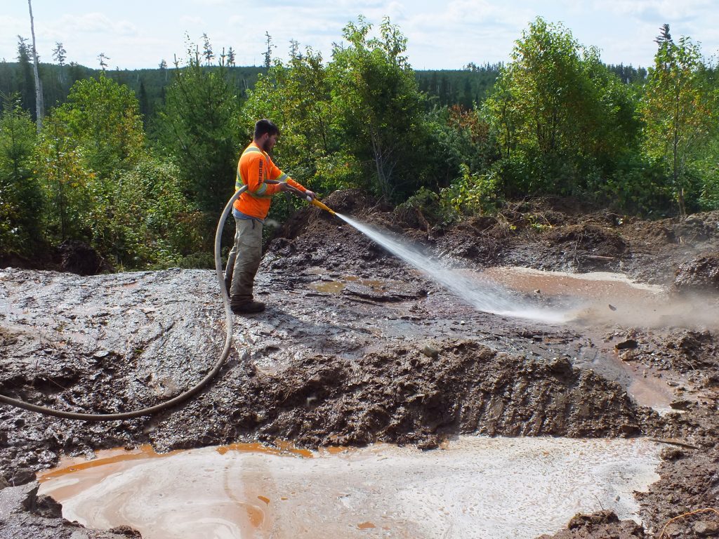
In 2017, Rainy Mountain Royalty Corp. completed a trenching program on the “East Grid” of the Brunswick Property which has revealed two new zones.
East Grid Trenching Highlights:
- 800m extension to west of original gold showing exposed by trench with .388 gm gold (Au) grab sample.
- Strong mineralization exposed on extensions from drill hole BE04.
- Assays of .12 gm gold (Au) in veins with chalcopyrite (copper), 200m west of drill hole BE04 with pathfinder elements detected.
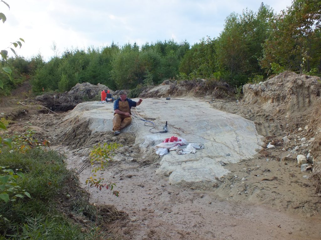
Rainy Mountain subsequently completed trenching and sampling on the East Grid of the Property, which has exposed a strong deformation zone extending from drill hole BE04 (see the Company’s news releases of July 12, July 17 and August 28, 2017 for additional details). This zone contains quartz veins up to 1.0m in width that contain chalcopyrite (copper) striking in the same direction as the major shear associated with the 2.1 km long Induced Polarization (“IP”) anomaly tested by drill hole BE04. This shear is 400m north of the Ridout Fault and is parallel to that structure. Trenching has exposed this structure from line 50100E to line 49750E at 97+00N (a distance of 350m of mineralization). Assays from grab samples along this structure yielded .12 gm gold (Au) (check assay pending) from both carbonate rock with sulphides and quartz veins with chalcopyrite (Cu). Very anomalous arsenic (As) values, and Vanadium (V), copper (Cu), and antimony (Sb) were associated with this zone. Drill hole BE04 itself contained the highest arsenic value found to date on the Property of 8380 ppm and four very anomalous gold values of .298, .113, .207, and .364 gm gold (Au), attracting the Company’s special attention to this zone.
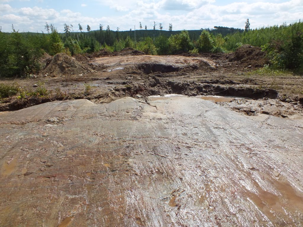
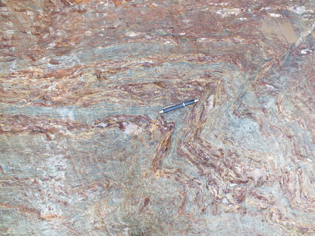
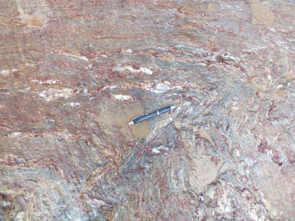
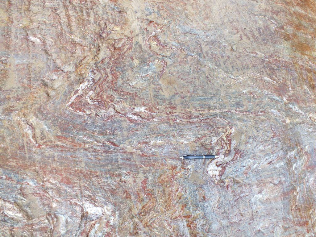
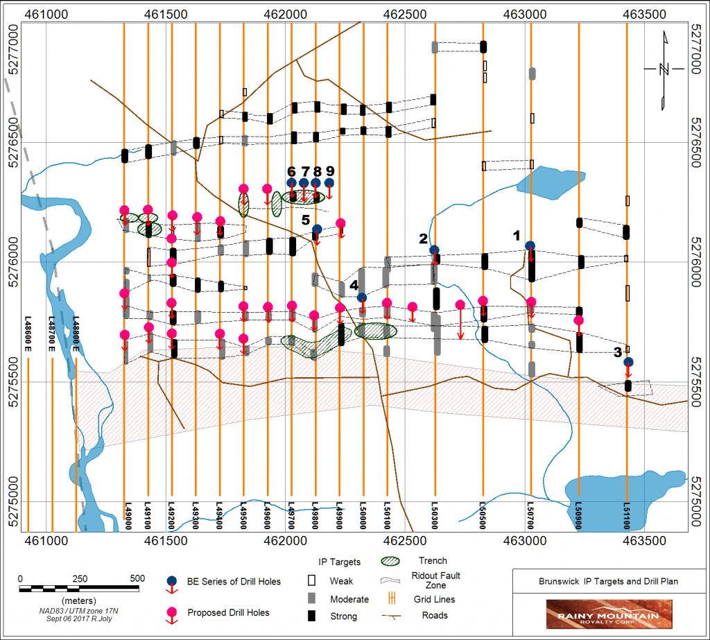
Trenching has also exposed another deformation zone extending west from the original gold showing on line 49800 at 102+50N to line 49000E at 102+25N. Photos of this zone are posted below in the photo gallery. Above is a map of the East Grid of the Property showing the IP anomalies, completed drill holes, proposed drill holes and trench locations. Assays of .31 gm gold (Au) (check assay .388 gm Au) were obtained from folded quartz veins in this deformation zone at line 49000, 102+20N, similar to the halo gold values seen at the original showing. Elevated arsenic (As), silver (Ag), and lead (Pb) values were also seen in this zone. Drilling is required to more accurately cross section the geology and to properly sample all the veins in this structure. Soil gold anomalies are associated with this particular deformation zone, which is encouraging the Company to do further drilling along strike.
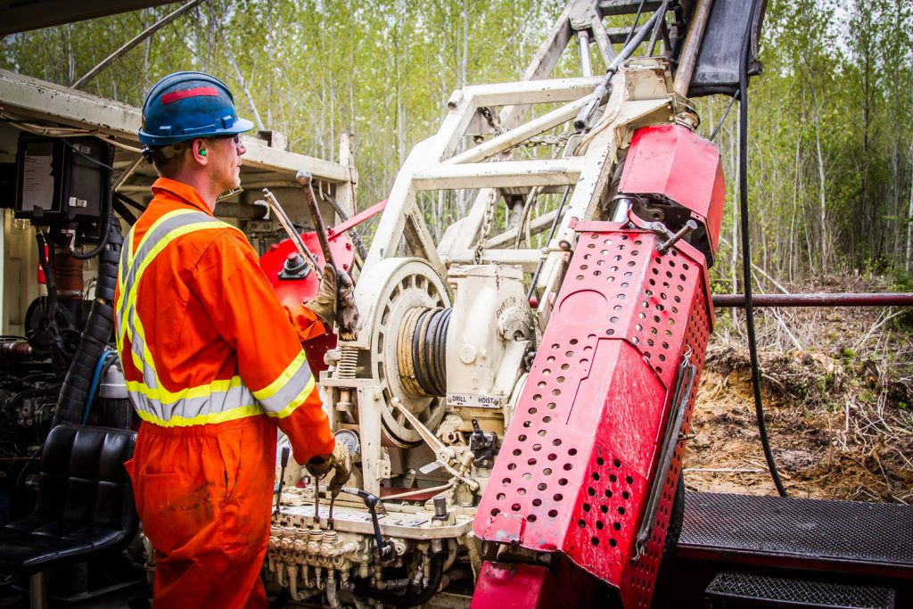
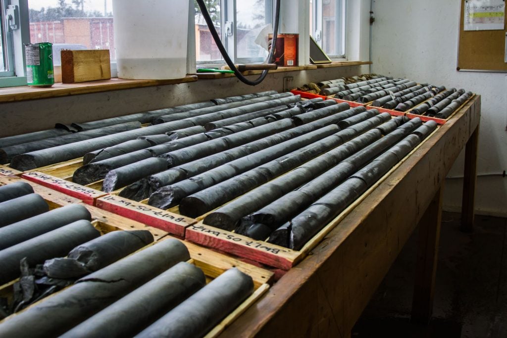
In March 2018, Rainy Mountain completed a drill program that included 15 holes for a total length of 1419 m.
Drill highlights:
- Assay of .440 gm gold (Au) over 1.0 m in drill hole BE18-02
- Assay of .650 gm gold (Au) over 1.0 m in drill hole BE18-04
- Assay of .132 gm gold (Au) over 1.0 m in drill hole BE18-06
- Assay of .242 gm gold (Au) over 1.0 m in drill hole BE18-07
- Assay of 1.59 gm gold (Au) over 1.0 m in drill hole BE18-08; the small-sample acid-digestion result was not validated by a 30 g fire assay (see discussion below)
As part of the drill program, three holes tested the extension of the original gold showing, 600m west, 300m west and 900m east of drill hole BE17-07 (see the Company’s news release of July 12, 2017). The original gold showing is located in a trench at 102+50N on line 49800E on the east grid of the Brunswick Property. A strong deformation zone was exposed in August 2017 west of the showing containing anomalous gold (Au) of .322 gm, and this anomalous section was hit by drill hole BE18-02 on line 49200E, and in drill hole BE18-06 on line 49500E. A strong zone of albitization was cut by hole BE18-04 900m east of the original gold showing, and this section was subsequently followed up by two additional lines of induced polarization (“IP”) which traced the IP anomaly associated with disseminated sulphides over a length of 300m.
Detailed Discussion and map:
 Drill holes BE18-01 and BE18-02 each tested a deformation zone 600m and 800m west of the original gold showing which yielded anomalous arsenic values in hole BE18-02 and a gold value of .440 gm gold (Au) over 1 m. These two holes were testing the deformation zone exposed by trenching in August 2017.
Drill hole BE18-03 tested a strong IP anomaly 150m north of hole BE18-01 in a new subparallel shear which extended 1300m to the east north east and had never been tested before. An 11m wide disseminated sulphide zone was cut with narrow porphyry zones. Low gold values were found, but geologically this shear may warrant further investigation.
Drill hole BE18-04 was drilled 900m east of the original gold showing and cut albitized zones and a wide disseminated sulphide zone with assays of .650 gm gold (Au) over 1.0m.
Drill hole BE18-05 was drilled to test the second parallel shear north of the one tested by drill hole BE 18-03 at a point 900m east of hole BE18-03 and it cut an 11m wide disseminated pyrite zone in a sheared volcanic similar in appearance to hole BE18-03, but had folded grey quartz veins with sulphides. This zone also contained low gold values but may warrant further testing and use of pathfinders to vector into a gold zone.
Drill hole BE18-06 was drilled 200m west of the original gold showing into part of the deformation zone. Assays of .132 gm gold (Au) over 1.0 m were found.
Drill holes BE18-07, BE18-08 and BE18-09 were drilled to test a different shear zone 550m south of the original gold showing and cut intensely carbonated (ankeritized) zones with quartz and pyrite. These three drill holes were step out holes from BE17-04 which contained anomalous gold and arsenic (see the Company’s news release of July 12, 2017). Drill hole BE18-08 drilled 100m west of BE17-04 yielded 1.59 gm gold (Au) in a small 2 gm sample with acid digestion, but was not validated by a 30 gm Fire Assay. The strong arsenic values on this shear, particularly in drill hole BE18-09, has left this zone as a possible follow up target. Drill hole BE18-07 also gave .242 gm gold (Au) over 1.0 m confirming the anomalous nature of this structure.
Drill holes BE18-10 and BE18-11 cut a wide disseminated pyrite zone in a porphyry 2 km east of the original gold showing but yielded low gold values. Hole BE18-12 cut sulphides in mafic volcanics 2.1 km east of the original gold showing with 1 m of anomalous base metals. Hole BE18-13 cut a narrow oxide iron formation in the same package of rocks as hole BE 18-12, 1.5 km east of the original gold showing. Hole BE18-14 cut a strong IP anomaly with intense quartz stockwork occurring in carbonated volcanics but containing low gold values. Hole BE18-15 tested a shear zone with iron carbonate- sericite alteration with low gold values.
No drilling was done at this time on the west grid of the Property where values have been located of 6.6 gm near line 48800E. This remains a target to be followed up where untested IP anomalies occur.
In conjunction with the drill program, an IP survey was run on 12 lines on the east grid of the Property which has traced the major shears that parallel the Ridout Fault and, in particular, the zone tested by BE17-04 which now extends 1700m east of drill hole BE17-04 and continues eastward.
Six lines of magnetics were also done on the west grid of the Property over wet areas not accessible in the summer and an IP survey is planned over this part.
 (4 MB)